
- Collection of
- Edo-Tokyo Museum
- Title
- Tokyo City Plan Map, Use Districts Edition, Map 10, Ōtaku
- Collection ID
- 87100836
- Category
- Printed Material
- Creation Date
- 1971 20世紀
- Size
- 109.2cm x 77.6 cm
- Edo-Tokyo Museum Digital Archives
- https://www.edohakuarchives.jp/detail-151009.html
Other items of Edo-Tokyo Museum (159764)

Sketch: Portraits of Sumo Wrestlers, Mitsuneyama, 3
Edo-Tokyo Museum
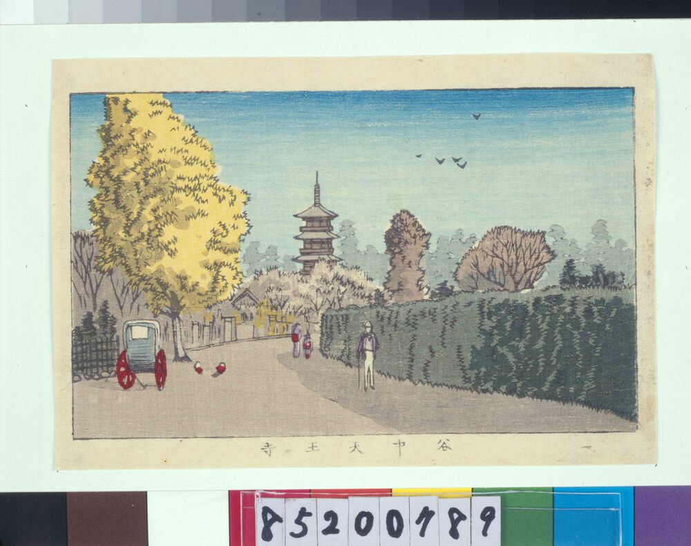
True Pictures of Famous Places in Tokyo: Tenno-ji Temple, Yanaka
INOUE Yasuji
Edo-Tokyo Museum
Document of Litigation
Edo-Tokyo Museum
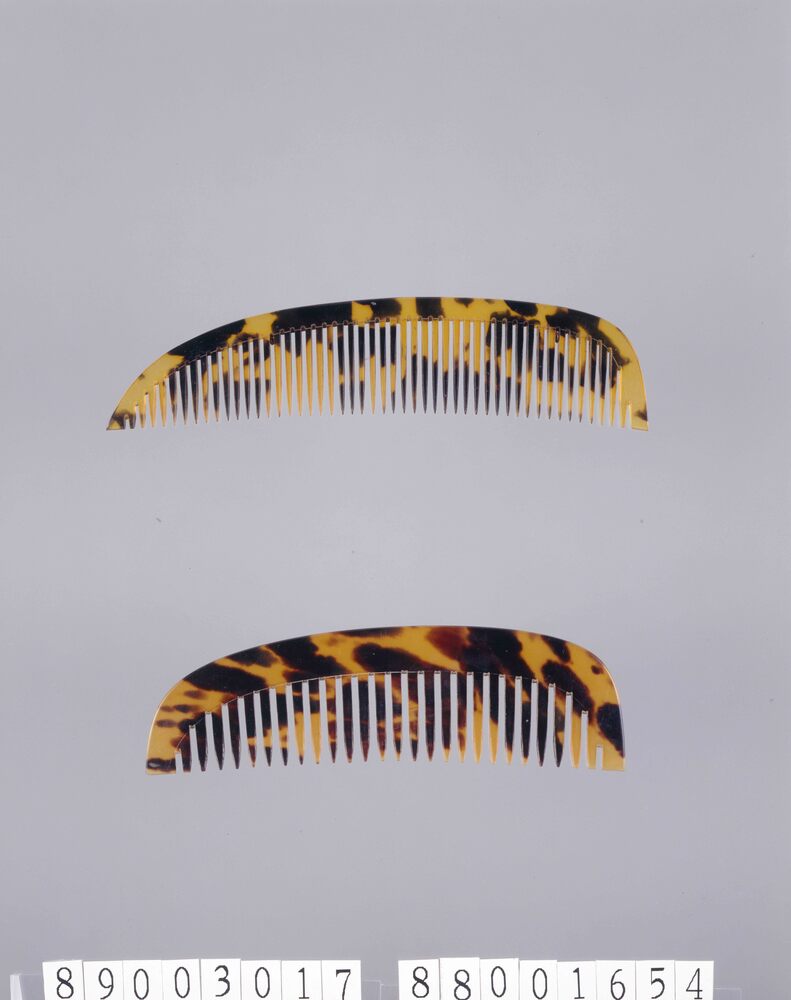
Comb
Edo-Tokyo Museum
Edo-Tokyo Museum
Edo-Tokyo Museum
Timetable of Train Arrivals and Departures at Kuki Station
Edo-Tokyo Museum
Lyric Sheet, Theme Song of Shōchiku Film “Nure Tsubame,” Victor Records
Edo-Tokyo Museum
![作品画像:[大正天皇]](https://museumcollection.tokyo/wp-content/uploads/2025/07/497784-L.jpg)
Emperor Taishō
Edo-Tokyo Museum
Document of Litigation
Edo-Tokyo Museum
Edo-Tokyo Museum
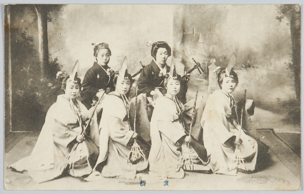
Performance
Edo-Tokyo Museum
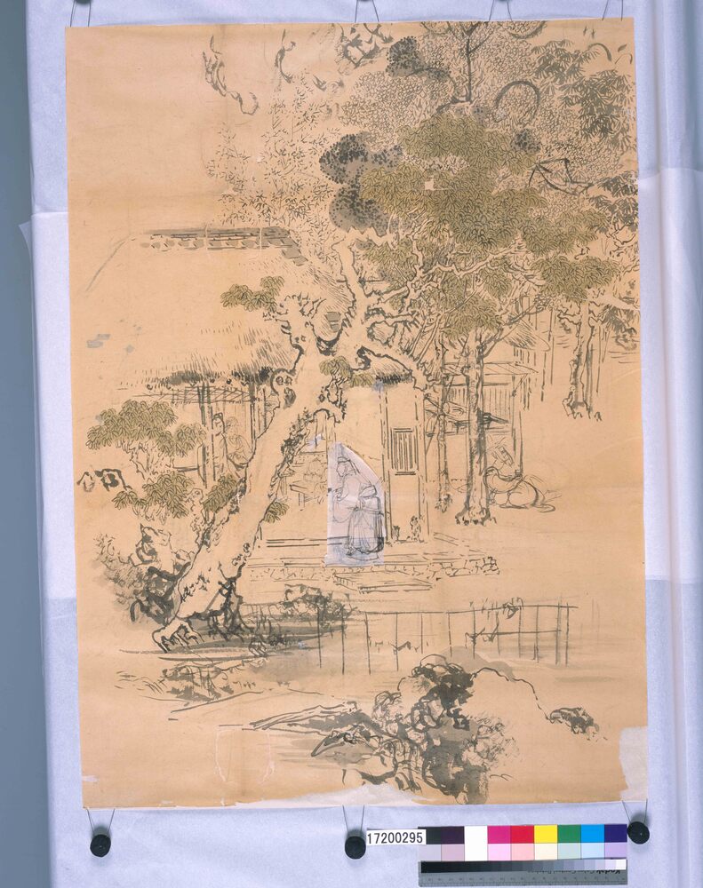
Visit of a Person with Integrity (Shibata Zeshin's Sketch)
[Shibata Zeshin]
Edo-Tokyo Museum
Pamphlet of Performance in February 1954 at Shinbashi Enbujō Theatre: Joint Grand Shimpa Performance in Commemoration of the 7th Anniversary of the Theatre, Saigetsu, Saikon Ryokō, Zangiku Monogatari, Ashiato, Ōsaka no Tsuji, and Shimbashi Yawa
Edo-Tokyo Museum
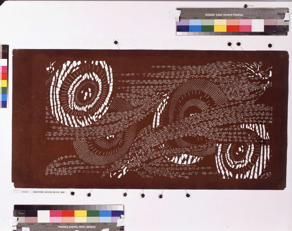
Nagaita Chūgata, Dyeing Samples 35 (688-707)
Edo-Tokyo Museum
Private Document
Edo-Tokyo Museum