
Tokyo City Plan Map, Fire Prevention and Vacant Land Districts Edition, Map 19, Itabashiku 東京都市計画図防火・空地地区編 第19図板橋区
- Collection of
- Edo-Tokyo Museum
- Title
- Tokyo City Plan Map, Fire Prevention and Vacant Land Districts Edition, Map 19, Itabashiku
- Collection ID
- 87100822
- Category
- Printed Material
- Creation Date
- 1971 20世紀
- Size
- 109.2cm x 77.6 cm
- Edo-Tokyo Museum Digital Archives
- https://www.edohakuarchives.jp/detail-150995.html
Other items of Edo-Tokyo Museum (159764)

Inn Kago no Kijū, Business Card
Edo-Tokyo Museum
Document of Contract
Edo-Tokyo Museum
Rokubu Kanna (Plane with 6-bu (65 MM) Wide Blade)
Edo-Tokyo Museum
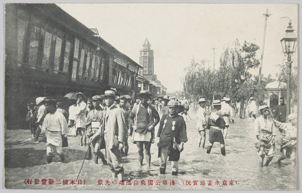
(Actual Scene of the Flood Disaster in Tokyo) Scene by the Side of the Okuyama Pond, Asakusa Park
Edo-Tokyo Museum
Inhaler
Edo-Tokyo Museum
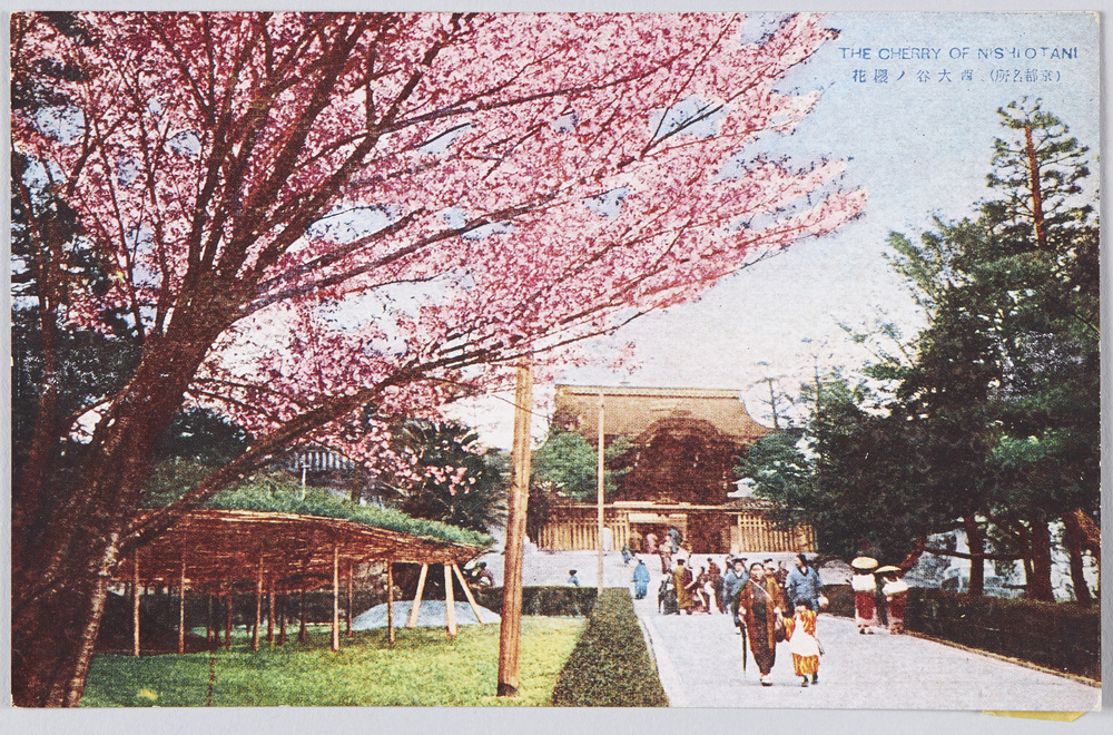
(Famous Views of Kyōto) Cherry Blossoms at the Ōtani Hombyō Mausoleum (Nishiotani)
Edo-Tokyo Museum
A Bundle of Karuta Playing Cards, Large (10 Pieces of Confectionery)
Edo-Tokyo Museum
Official Postcard with Prepaid Reply (5 Yen for Sending and 5 Yen for the Reply)
Edo-Tokyo Museum
Wooden Signboard in Votive Tablet Shape: "Shiba Nihonenoki" Yūkanren
Edo-Tokyo Museum
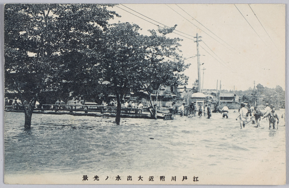
Scene of the Great Flood near the Edogawa River
Edo-Tokyo Museum
Garden Fixtures Purchase Book
Edo-Tokyo Museum
Picture on Round Fan by Haibara Shūgyokudō: Thistle
Edo-Tokyo Museum
Balance Sheet for the 1st Performance
Edo-Tokyo Museum
Notification of Income Amount (For 1900)
Edo-Tokyo Museum
1917 Maichō Yōhai Benran
Edo-Tokyo Museum
Jiji Shimpō, 1935, No. 18591, Evening Edition
Edo-Tokyo Museum