
- Collection of
- Edo-Tokyo Museum
- Title
- Detailed Transportation Map of Kantō and Surrounding Regions
- Collection ID
- 87100751
- Category
- Printed Material
- Creation Date
- 1946 20世紀
- Size
- 38.0 cm x 53.5 cm
- Edo-Tokyo Museum Digital Archives
- https://www.edohakuarchives.jp/detail-150922.html
Other items of Edo-Tokyo Museum (159764)

Materials on Utsushi-e (Magic Lantern Show) in the Osaka Museum Collection, Photograph Album
Edo-Tokyo Museum
Document of Laws
Edo-Tokyo Museum
Photo News on Political and Social Situations in Early Shōwa Period
Edo-Tokyo Museum
Tools for Making Kawara Roof Tiles: Aragata, a Tool for Making Hiragawara (Flat Roof Tiles)
Edo-Tokyo Museum
Document of Laws
Edo-Tokyo Museum
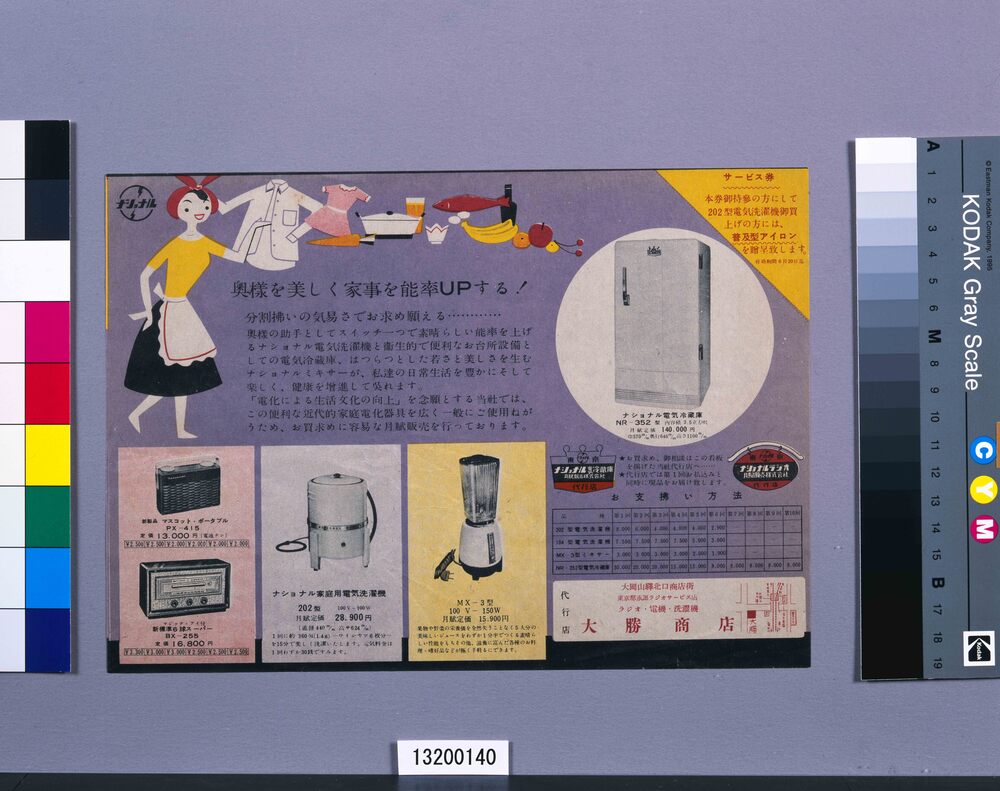
Make the Woman of the House More Beautiful and Housework More Efficient! (Flyer for Household Appliances)
Edo-Tokyo Museum
Private Document
Edo-Tokyo Museum
Shūgyoku Bukan (Pocket-Sized Directory of Government Officials)
Edo-Tokyo Museum
Document of Contract
Edo-Tokyo Museum
Document of Contract
Edo-Tokyo Museum
Osaka Kabukiza Theater Program for September 1954
Edo-Tokyo Museum
Edo-Tokyo Museum
1:10,000 Topographic Map of Hatogaya
Edo-Tokyo Museum
Shade, Argand Lamp Part
Edo-Tokyo Museum
Electric Light Operation Handbook
Edo-Tokyo Museum
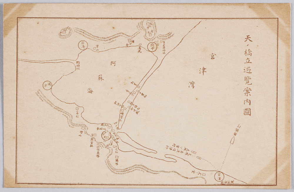
Amanohashidate Sightseeing Guide Map
Edo-Tokyo Museum