
Map of the Southwestern Part of Kinuta (Tokyoshi, Setagayaku, Kitatamagun, Komaemura, 39-6) 砧西南部地図(東京市世田谷区北多摩郡狛江村 三十九号ノ六)
- Collection of
- Edo-Tokyo Museum
- Title
- Map of the Southwestern Part of Kinuta (Tokyoshi, Setagayaku, Kitatamagun, Komaemura, 39-6)
- Collection ID
- 85200280
- Category
- Printed Material
- Creation Date
- 1939 20世紀
- Size
- 49.5 cm x 59.0 cm
- Edo-Tokyo Museum Digital Archives
- https://www.edohakuarchives.jp/detail-147527.html
Other items of Edo-Tokyo Museum (159764)

Kujira Tengoku: 34th, “The Asahi Weekly Edition”, Oh, Here Comes the Orcas
Edo-Tokyo Museum
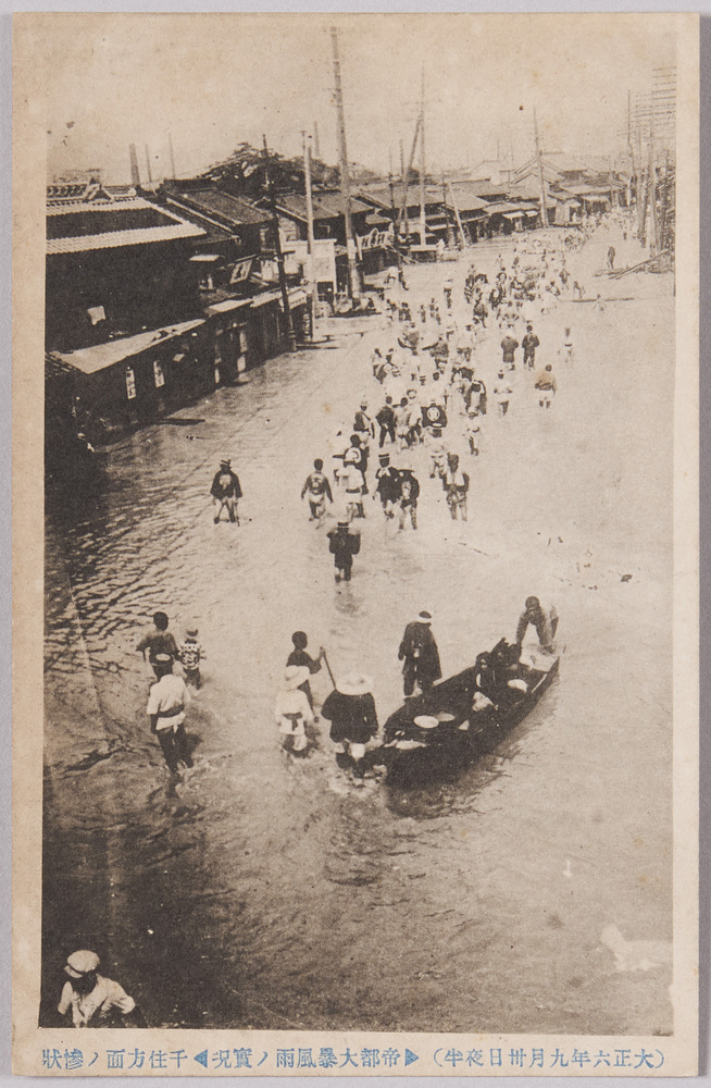
Midnight on Sept. 30, 1917, Photo of the Aftermath of the Severe Storm in Tokyo
Edo-Tokyo Museum
Map of Gifushi Park
Edo-Tokyo Museum
Document of Rural Area
Edo-Tokyo Museum
Edo-Tokyo Museum
Taxi Konjaku Monogatari Illustration (Flat Rate System in the City)
Edo-Tokyo Museum
Keio Railway Line Guide
Edo-Tokyo Museum
Playing House Set
Edo-Tokyo Museum
7-sen One-zone Bus Ticket Commemorating the Reconstruction of the Imperial Capital
Edo-Tokyo Museum
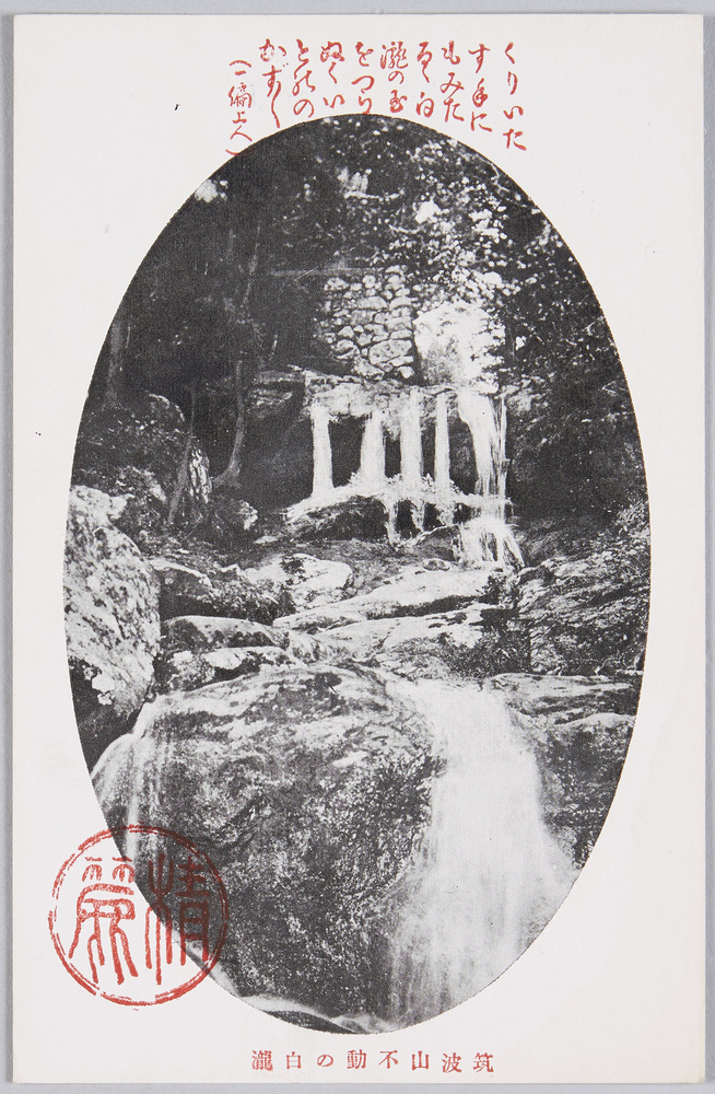
Shirataki Waterfall at the Fudō Pass on Mt. Tsukuba
Edo-Tokyo Museum
Hand-copied Book of Japanese Tea Ceremony
Edo-Tokyo Museum
Program: Onna to Kaizoku and More
Edo-Tokyo Museum
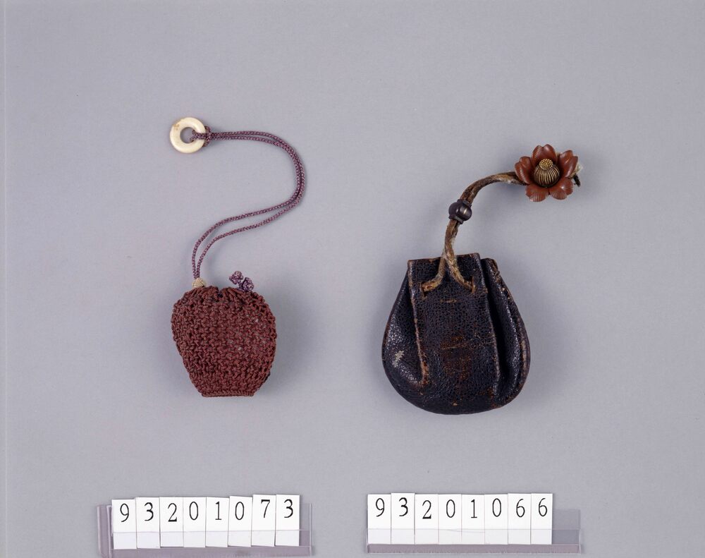
Black Leather Drawstring Pouch
Edo-Tokyo Museum
Document of Rural Area
Edo-Tokyo Museum
Silver Jintan Case
Edo-Tokyo Museum
![作品画像:[新改 宝暦武鑑 巻之四]](https://museumcollection.tokyo/wp-content/uploads/2025/07/1543636-L.jpg)
[Shinkai Hōryaku Bukan] (Directory of Government Officials, New and Revised Edition), Vol. 4
Edo-Tokyo Museum