- Collection of
- Edo-Tokyo Museum
- Title
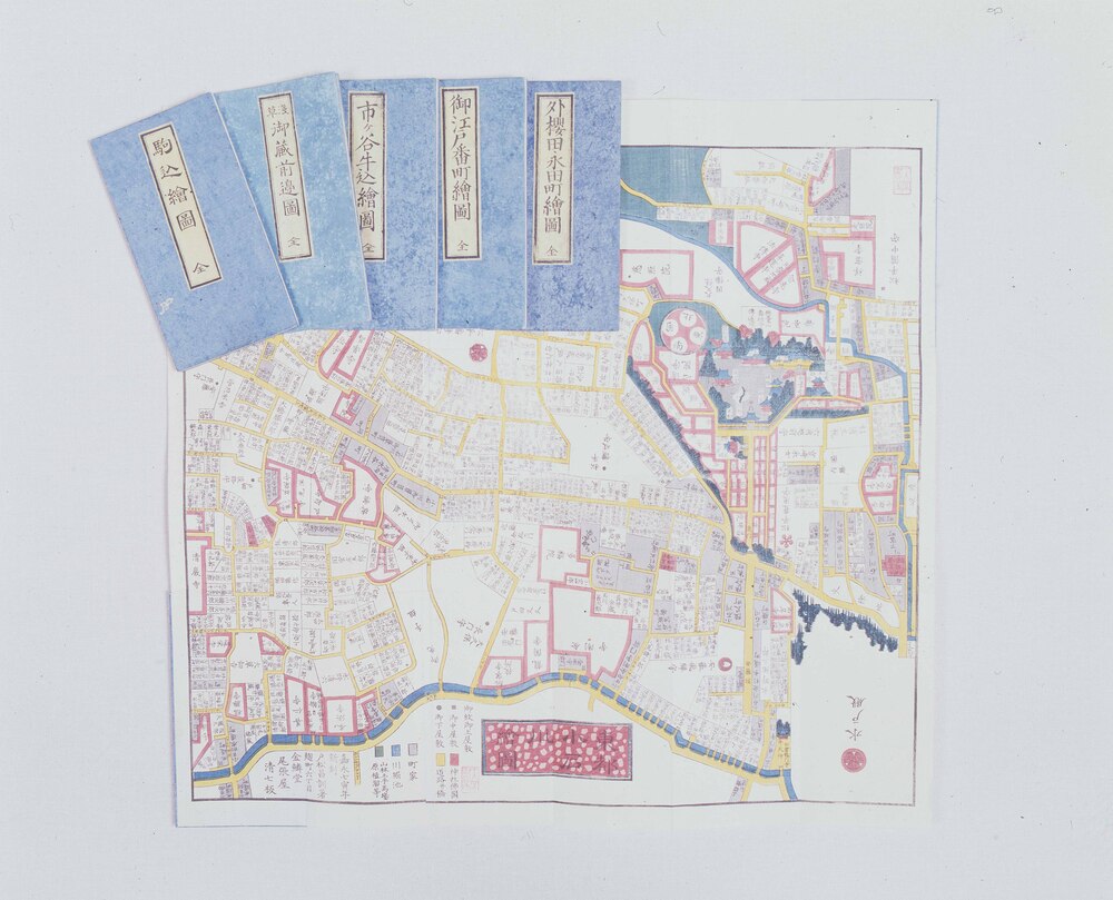
- Edo Kirie Zu Area Maps by Owariya, Oedo Banchō Area Map
- Collection ID
- 82101215
- Category
- Printed Material
- Creation Date
- 1852 19世紀
- Size
- 49.8 cm x 53.8 cm
- Edo-Tokyo Museum Digital Archives
- https://www.edohakuarchives.jp/detail-145206.html
Other items of Edo-Tokyo Museum (159764)
3, Sengoku Zōhyō: Snail
Edo-Tokyo Museum
Seikei Gakuen Student Shirtless Exercise in the Snow (Elementary School)
Edo-Tokyo Museum
Practical Sewing Thread, Black
Edo-Tokyo Museum
Talisman: Protection from Measles
Edo-Tokyo Museum
Komagatadō Temple, Kuramae
Edo-Tokyo Museum
Document of Rural Area
Edo-Tokyo Museum
Floor Plan for [the Jiji Shinpōsha Building]
Edo-Tokyo Museum
(Great Tokyo Flood of August 1910, 125 Years after the Temmei Era Flood Disaster) *Scene of the Disaster of the Inundation in the Senju District
Edo-Tokyo Museum
Famous Landmarks of Nagoya
Edo-Tokyo Museum
A Thousand Views of Tokyo: Pen Sketch, Meiji Kinenkan, Minatoku
Edo-Tokyo Museum
Seki no Magoroku Japanese Sword Buying Club, Guide to Buying Nōshū Sekiden Japanese Swords
Edo-Tokyo Museum
Private Document
Edo-Tokyo Museum
Illustrated Overview of Air Defense in the East Region
Edo-Tokyo Museum
Public Service Bag
Edo-Tokyo Museum
Famous Views of Tokaido Road : Sakanoshita near Mount Suzugayama , Tsuchiyama , Tokaido Road
Chikamaro
Edo-Tokyo Museum
Sonjō Kiji (Japan's Political and Diplomatic History of Late Edo Period), Supplement
Edo-Tokyo Museum