
Large Map of New Roads in Key Areas of Tokyoshi, Map of Reconstruction in Tokyo and Yokohama 東京市枢要地区新道路拡大図・東京及横浜復興地図
- Collection of
- Edo-Tokyo Museum
- Title
- Large Map of New Roads in Key Areas of Tokyoshi, Map of Reconstruction in Tokyo and Yokohama
- Collection ID
- 96006826
- Category
- Printed Material
- Creation Date
- 1924 20世紀
- Size
- 78.9 cm x 109.3cm
- Edo-Tokyo Museum Digital Archives
- https://www.edohakuarchives.jp/detail-240011.html
Other items of Edo-Tokyo Museum (159764)

Site of Imperial Open-Air Tea Ceremony Held by Emperor Meiji
Edo-Tokyo Museum
Document of Samurai Class, Document Related to Blue Print
Edo-Tokyo Museum
Edo-Tokyo Museum
Public Document
Edo-Tokyo Museum
Document of Rural Area
Edo-Tokyo Museum
Envelope for Picture Postcards of Eight Views of Uji
Edo-Tokyo Museum
Shinsen Daiku Hinagata (Book of Architecture Designs for Carpenters)
Edo-Tokyo Museum
Sketch from Kanton Oboechō (Park Scenery)
Edo-Tokyo Museum
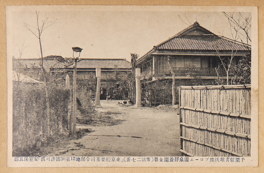
Aohori Iodine-Bromine Hot Springs, Chibaken: Full View of the Seiyoen Hotel
Edo-Tokyo Museum
Unlined Obi Sash (For Children)
Edo-Tokyo Museum
Bag for LION Toothpaste
Edo-Tokyo Museum
A Thousand Views of Tokyo: Pen Sketch, Otaki Bridge, Shinjukuku
Edo-Tokyo Museum
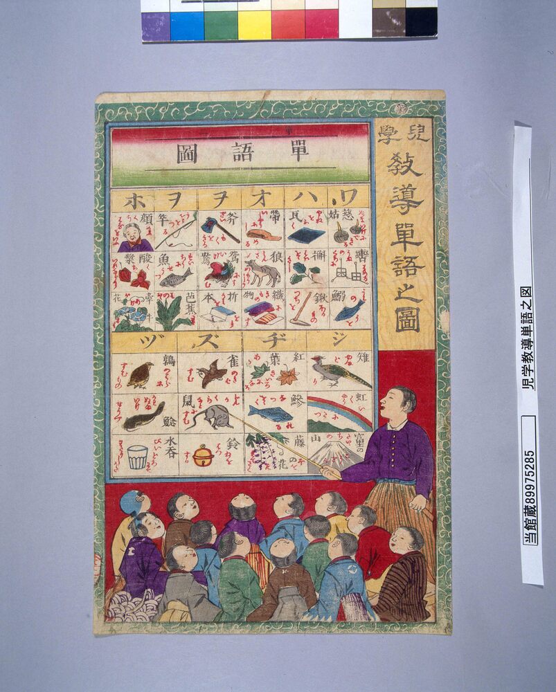
Jigaku Kyōdō Tango no Zu (Illustrated Vocabulary for Children), No. 2
Edo-Tokyo Museum
Lead Menko: Samurai and Dragon
Edo-Tokyo Museum
Picture Postcards of Foreign Soldier
Edo-Tokyo Museum
Fortune Slip of the Asakusa Kannondō Temple: No. 70, Kyō (Curse)
Edo-Tokyo Museum